HUDSON COUNTY — If you woke up Sunday morning thinking mayyyyybe Hurricane Sandy had changed course and was heading out to sea….well, no.
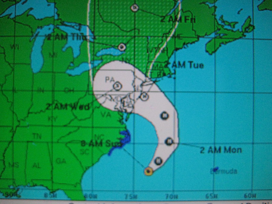
The updated map for Sunday from the National Weather Service shows Hurricane Sandy smacking straight into the distended stomach of the Jersey Shore, around Atlantic and Ocean counties.
Officials say that downed power lines could cause seven to 10 day power outages and dangerous conditions.
Gov. Chris Christie declared a state of emergency this weekend.
The worst of the storm is expected to arrive Monday night into Tuesday, and Wednesday is expected to be somewhat rainy and windy as well.
In Jersey City, the city website released an update after 4 p.m. Saturday saying they were suspending garbage and recycling pickups immediately, and urging residents in low lying areas to park their cars indoors or on higher ground. Also, sandbags were available from the city starting Sunday.
Winds were already gently swaying the autumn leaves in Hoboken on Sunday morning. The city has been recruiting volunteers on Saturday and Sunday to help out in the storm.
Here is a link to the NWS hurricane website so you can directly click on the latest storm track map.
Various residents were tweeting about the storm. We’ll be posting some of them later, as well as more storm information and news, as long as we have power.
So keep watching hudsonreporter.com! If you have news or photos, email them to editorial@Hudsonreporter.com.
Our Digital Archive from 2000 – 2016