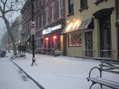
HUDSON COUNTY — It’s the winter that just won’t quit. It may remind some hardy residents of the winter in the mid-1990s when there were dozens of snowstorms and during one of them, Hoboken Mayor Anthony Russo closed Hoboken streets to outside vehicles to keep heavy traffic from coming through town. He got some praise and some criticism for that one.
This winter, we’ve had a few bad storms, and Accuweather is saying that Tuesday night through Wednesday, we MAY get another.
The following statement from the National Weather Service was issued Sunday:
THERE IS A POTENTIAL FOR A WINTER STORM LATE TUESDAY NIGHT INTO THURSDAY.
AS AN ARCTIC HIGH PRESSURE SYSTEM MOVES EAST OFF THE NEW ENGLAND COAST…A LOW PRESSURE SYSTEM IS FORECAST TO DEVELOP OVER THE GULF OF MEXICO MONDAY NIGHT. AS THIS LOW MOVES NORTHEAST AND INTENSIFIES…ABUNDANT MOISTURE FROM BOTH THE GULF OF MEXICO AND WESTERN ATLANTIC OCEAN WILL BE DRAWN INTO THIS SYSTEM.
BECAUSE MODELS SHOW A VARIETY OF TRACK AND INTENSITY FORECASTS… THIS IS A LOW CONFIDENCE FORECAST.
DEPENDING ON ITS TRACK…PARTS OF THE LOCAL AREA COULD EXPERIENCE HEAVY RAIN…FREEZING RAIN…HEAVY SNOW…STRONG WINDS…COASTAL FLOODING AND BEACH EROSION.