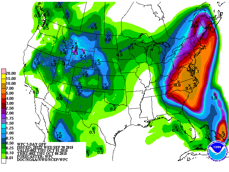
HOBOKEN – Hurricane Joaquin could make landfall in Hoboken and cause heavy rainfall and high tides over the next few days, the city’s Office of Emergency Management announced Wednesday, Sept. 30.
In a citywide alert, officials said the possibility of inland flooding has increased for Friday, Oct. 2 and Saturday Oct. 3 – with the chance of up to six to eight inches of additional rain over the next week. In addition, the National Weather Service has issued a Coastal Flood Advisory from Thursday, Oct. 1 from 6 a.m. to Friday, Oct. 2 at 6 a.m. and a Coastal Flood Watch on Friday, Oct. 2 from 6 a.m. to 6 p.m.
“We are closely tracking weather forecasts, talking to experts at Stevens [Institute of Technology], and planning for a serious one-two punch from back-to-back storm systems that could cause serious flooding from late Thursday into early next week,” said Mayor Dawn Zimmer in a statement.
According to the alert, forecasters predict the hurricane may directly impact New Jersey on Sunday, Oct. 4 and could lead to record flooding depending on its trajectory.
“Our Office of Emergency Management team is coordinating with all departments and agencies and making preparations to ensure the safety of our community,” added Zimmer. “Most importantly, now is the time for residents to make sure that they have a plan in place and are prepared for all possibilities.”
A number of measures have already been put in place throughout the city: a high-water vehicle is ready to be deployed along with several small boats, municipal vehicles have been moved to higher ground along Washington Street between Observer Highway and Second Street, as well as Thirteenth to Fourteen streets.
The city is also preparing backup generators, filling a potable water tank, and coordinating plans to open a shelter and distribution center if necessary.
“Barricades have also been pre-positioned to close off streets and ‘No Parking’ signs have been posted in the most flood-prone areas to inform drivers of the possibility of flooding,” the announcement reads.
While the trajectory of the storm may shift, Superstorm Sandy in 2012 which led to blackouts and major flooding, made the case for being proactive.
Residents are advised to take the following precautions. The Hudson Reporter will track the storm and maintain the website with updated information:
• Sign up for the City’s Reverse 911 system at www.hobokennj.org/emergency and for email and text alerts through the Nixle system at www.hobokennj.org/alerts
• Download weather apps, monitor weather forecasts, and sign up for weather alerts
• Move parked vehicles from low-lying flood-prone areas to higher ground. A map of the most flood-prone areas is available at www.hobokennj.org/flooding, however flooding is possible beyond these areas
• Bring in unsecured objects from patios and balconies and secure outdoor objects such as lawn furniture or garbage cans that could blow away and cause damage or injury
• Create a family emergency communication plan and have an emergency kit ready
Our Digital Archive from 2000 – 2016
