As midnight neared on Oct. 29, the waters of the Hackensack River were 8.6 feet deep, five feet higher than normal high tide. Swelled by winds pushing ocean water and filled with debris, the tide had risen steadily throughout the day and persisted for six hours at that peak height, flooding homes in low-lying areas along the river.
For many homeowners, the presence of Hurricane Sandy had been felt moments before, when the lights went out and plunged many neighborhoods into darkness. In Secaucus, homes began filling up with water that rushed in so fast homeowners scrambled to respond.
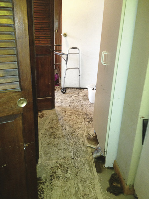
Many people who lived in low-lying areas experienced several feet of flooding, at least twice as much as that caused by Tropical Storm Irene in 2011. The water swept into basements and first floors and damaged homes in areas located along Farm Road, Acorn, Oak, Gail Place, Valley Court, Millridge Road, 10th Street, Huber Street, and Meadowlands Parkway.
Now, officials are talking about how to deal with similar events in the future.
Recounting rising tide
“I don’t think there is anyone alive today who has [ever] experienced this,” said Dr. Francisco Artigas, director of the Meadowlands Environmental Research Institute (MERI), which is the science and technology arm of the New Jersey Meadowlands Commission.
Artigas on Jan. 11 presented MERI’s findings regarding data that was collected during Hurricane Sandy to a group of journalists. Earlier in the day, the NJMC had presented the findings to the Army Corps of Engineers.
While MERI lost important field monitoring equipment during the storm, two of its monitoring stations located near areas that flooded remained functioning and were able to collect invaluable data about water levels during the storm.
“You are as strong as your weakest link.” – Francisco Artigas
____________
On Oct. 29 at approximately 2 p.m. as the hurricane approached, low tide was at an average of 3 feet, which is equivalent to a normal high tide. Shortly before 6:30 p.m. the tide had reached the height of the riverbanks, which are approximately 5 feet high.
The sea surge began at approximately 8 p.m. and lasted until approximately 2 a.m. on Oct. 30. During this time, MERI recorded average water levels at River Barge Park Marina in Carlstadt of 8.6 feet and 9 feet at the Moonachie tide gate, with periodic tidal surges measuring well above 10 feet. The surge flooded the NJ Turnpike, which is at 10.2 feet.
But what was most striking about the data regarding the tidal surge was how long it remained at peak levels, according to NJMC scientists.
“From our data and continuance data logs we were able to determine here the length of time the water remained above a certain level,” said Artigas. “It was about six hours above 7 feet…and over 10 hours above 6 feet.”
“It is not tsunami-like, where water that comes in washes back out,” noted Thomas Maturano, director of solid waste and natural resources.
He described the area behind the berms – natural or man-made barriers against flooding similar to levees – as a bathtub that had water pouring into it for more than six hours.
Uneven berms
The tidal surge flooded over the highest berms that measure up to 7 feet in some places. Constructed berms within the Meadowlands estuary connect to earthern, natural berms, which are all at varying heights but average 5 feet.
“You are as strong as your weakest link,” said Artigas.
The historic tidal surge, accompanied by 50-plus mile per hour winds, overtopped all flood control structures, riverbanks, creek banks, and berms in the Meadowlands, according to the NJMC.
Artigas said that the berms were overtopped by approximately 4 feet of water, and combined with friction, waves, and erosion, this caused spillways and led to the massive flooding.
“No matter how much anyone raises one particular area…everything has to be raised at the same elevation because otherwise the water is going to pour in at its lowest point,” said Karrow. “It is an unfortunate reality of this area.”
She noted that there are miles and miles of berms on private and municipal property whose ownership can’t always be determined.
Once in a lifetime?
“We are hoping this is a once in a 750-year experience,” said Karrow.
“We’ve never seen anything like this,” said Artigas. “750 sounds good to me.”
“Those berms were not built to protect anyone from water,” said Karrow. “They were built for mosquito control.”
The Mosquito Commission built berms in the early 1900s to keep the high tide off the low meadows and to provide structure so that it would flush the water out at low tide according to Artigas.
“To stop a surge of that magnitude you’d have to do what Venice did or Stamford, Conn.,” said Maturano. Stamford has a hurricane barrier and Venice, Italy has had a number of huge, submerged gates installed that rise and block rising water to prevent flooding.
“You’d have to block it off at its source…the problem is that you have roads that are low, the water will just come in over the roads.”
“I know everyone is looking for the silver bullet,” said Maturano. “I don’t think there is one.”
“This is a much bigger, more complex issue,” said Karrow.
Adriana Rambay Fernández may be reached at afernandez@hudsonreporter.com.
